Saturday, April 14, 2012

Mt Lawu

This Ribu has two excellent paths to the top from the south, with the two trailheads just 800 metres apart.  It is perhaps Java’s easiest 3,000m peak, especially since the paths starts at an elevation of 1,800m. It’s a great hike for those new to hiking in Indonesia. The closest town to the starting point is Tawangmanggu, about an hour’s bus ride from the city of Solo. Tawangmanggu has plenty of accommodation which is probably worth making use of so that you can get an early start the next morning.  Many of the roadside warungs at the trailhead will also let trekkers bed down for the night for a modest fee.
The trailhead for the “main” route is about 10 kilometres east from Tawangmanggu at Cemoro Sewu, just over the East Java border.  You are requested to register here. It is a very popular hike with Indonesian students and there is even a warung (shop) and well (for holy water), Sendang Drajad, near the top.  It is possible to climb and descend in one day (or to climb through the night, setting out at around 10pm to be sure of reaching the top for sunrise), but unless you are both incredibly fit and in a hurry, you will probably need to camp one night on the mountain. The mountain lies on the border of Central and East Java and sunsets over Merapi and Merbabu are nothing less than spectacular.


Apparently, the last king of Majapahit Empire in the 15th century, King Brawijaya V, retreated here – there is a prominent cave, Sumur Jolotundo, on the way up – and accordingly the mountain has significant traditional and spiritual significance for the Javanese.There Cemoro Sewu trail, which cuts up Lawu’s eastern flank, is roughly paved with stones the whole way up, with cut steps and handrails in places.  This makes it an attractive route during the wet season, as it does not get slippy.  The route is steep, however, and the rocky surface is not the most pleasant to walk on.  There are 5 posts (pos) on the way up, and it takes approximately one hour between each: Taman Sari Bawah (‘lower garden’), Taman Sari Atas (‘upper garden’), Pos Penggik (near the spring Sendang Panguripan) and Cokro Suryo which is a superb viewpoint. Beyond Cokro Suryo are some small cottages, Pesanggrahan Argo Dalem, and the warung where it is possible to spend the night, and a fifteen minute walk above the cottages is the peak, which is known as Argo Dumilah. There is a large cement column and spectacular views in all directions. The best places to camp are just below the cement pillar on the peak or lower down towards the cottages where porters usually to spend the night. It gets very cold near the top and unprepared climbers have died on Lawu so take extra layers of clothing with you.
After admiring the sunrise over the peaks of East Java, you can descend the same way in approximately 4 hours.
The second route starts at Cemoro Kandang, a short stroll west along the road from Cemoro Sewu, just across the bridge that marks the provincial border.  There is also an entry post here where you are required to register.
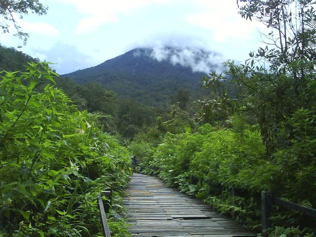
The Cemoro Kandang route is longer than the Cemoro Sewu trail, about 12 kilometres as opposed to 8 kilometres.  However, it is in many ways a more attractive route – the climb is less steep, thanks to a large number of switchbacks; it passes through pleasant forest, and offers more views in its middle sections.  It is also a “real” trail, rather than a paved path.
From the check-post the trail rises relatively gently through the forest to Post 1, where there is a hut.  Beyond here conditions remain similar until Post 2, another hut where there is also space to camp.  It takes between one and two hours to reach Post 2 from the road.  In this first section the trail is very well defined, although it is quite badly eroded in places, and muddy during the wet season.
Beyond Post 2 the trail cuts west, and begins to wind its way around the steep western flank of the mountain, passing another unnumbered post with a shelter.  Although the forest is quite thick here there are views through the trees down to Tawangmanggu, and, on a clear day, to Solo and Gunung Merapi and Merbabu.
The trail rises up the mountain in a long series of switchbacks, which makes the going easy.  Post 3 lies about halfway up the main climb, and beyond here the forest thins and the views become more expansive.  The trail is well defined all the way up, though there are places to cut corners on the switchbacks if you’re in a hurry.
The ground levels out at Post 4, and the trail begins to cut around to the northern side of the mountain, remaining level, and actually descending in places.  Around 45 minutes from Post 4 a metal sign marks a junction – straight ahead the trail continues to meet the Cemoro Sewu route at Pesanggrahan Argo Dalem, while to the right a short, rough path leads to the summit in around 10 minutes.
Despite being longer, the gentler climbs mean that the Cemoro Kandang route takes about the same time as the main Cemoro Sewu trail.  It is possible to reach the summit in under six hours if moving relatively quickly.  However, this route is less practical in wet weather (in early 2012 there were a lot of broken branches and fallen trees along the trail, the result of recent high winds, though they did not impede progress).
Given that the two trailheads are so close together, ascending by one route and descending by the other is an attractive option.  This would also allow you to make a full circuit of the peak.  Alternatively, if you’re feeling very adventurous, head northwest to visit the ancient Candi Ceto temple and then take an ojek or angkot back round to Tawangmanggu (30 minutes). If doing the latter, make sure you have a guide who knows the way as it is much less used than the ascent route from Cemoro Sewu.  The Ceto trail strikes north from near Pesanggrahan Argo Dalem and is around 16 kilometres in length.

Jalak Lawu
Jalak Lawu is one of enchanted animal in Lawu mountain. This bird is Lawu mountain endemic animal. However, based on society believe, this bird will follow the climber of Lawu mountain as guide. If the climber did not see Jalak Lawu in his trip, they are believed will be not save or will be lost in Lawu mountain

Kodingareng Keke Island

Kodingareng Keke Island located in Sub-District of Ujungtanah, Makassar. The distance is about 8.37 miles or 13.48 kilometers from the coastal city of Makassar.
Composed from white sand and was elected preservation centre because the island has the widest coral reefs.The condition of coral reefs and marine biota in the vicinity of the island is still intact and original.
Tourist can stay in trim cottages. Do something fun, like diving, swimming,with the clear waters without city waste contamination very good for snorkeling , than rest comfortably and also can enjoy sunbathing during the day.
WHITE sand, crystal clear sea and clean air are three of many charms of Kodingareng Keke Island. You can stay in cottages. The cottages are neat. You can do lot of fun activities and rest comfortably.
Kodingareng Keke Island located in Ujungtanah District, Makassar, South Sulawesi, Indonesia. The island is 8.37 miles or 13.48 kilometers from coast of Makassar.

Kodingareng Keke Island is one of 11 islands in the range of spermonde archipelago (spermonde shelf) in Makassar. This island extends from east to west. Total area of the island is one hectare. The beach is composed of white sand and various pieces of coral.

Sea around the coast of this island is fairly shallow. At lowest tide, there are quite wide plains, especially in the western side of the island. The depth is varies between five to 20 meters. While the eastern and southern sea south are the shipping lanes in and out Port of Makassar.

Sea around Kodingareng Keke Island is clear without contamination of city waste. This is an ideal location for snorkeling or diving. You can see the beautiful coral reefs and the biota on the seabed. Condition of coral and marine life around the island is still maintained and original.

While at the beach, white sand spread out so soft. You can sunbathe enjoying the warm sun during the day. Feel the breeze and rustling sounds because of leaf pine friction. Or you can relax and enjoy the beautiful moon at night. In the distance, you can see the Makassar city sparkling.

The island is not inhabited by residents. Since 2001 there stood the cottages. The Rates is pretty cheap. It is cheaper than hotel rates. Cottages are made of wood. It seemed natural. The conditions are clean and well maintained.

There is no regular shipping there. 40 PK motorboats are available at the pier of POPSA. You can rent it with IDR 300 thousand. The trip to this island takes about 40 minutes.

Samalona Island, South Sulawesi - Indonesia

Samalona is a small island in the Straits of Makassar, precisely on the southwest coast of South Sulawesi . Administratively, this island including the city of Makassar, South Sulawesi. Position more precisely located on the west district Wajo, Makassar, a distance of approximately 2 km and can be seen clearly from these districts.
  Samalona Island is a cluster of circular coral island with an area of 2.34 hectares. This small island is one nautical tourist destination visited by many local and foreign tourists.

White sand and crystal clear water make this island perfect for sunbathing. In addition, this island is very good area for diving (diving), because there are around coral reefs inhabited by diverse marine tropical fish, colorful, and other marine biota. The island is saving a million mystery about his wreck of the ship-relics of World War II. There are about seven boats that sank in the area of this island, among them: Maru ship, owned by a Japanese warship sank at a depth of about 30 meters; ship Lancaster Bomber which also sank at a depth of about 30 meters; submarine hunter (gunboat) Japanese-owned ; Hakko Maru cargo ship made in the Netherlands, and Japan's submarines.

Wrecked ships have been transformed into a reef and became a "house" or "residence" for hundreds of diverse marine life forms, and type and color that is very admirable. The beauty of this is the major attraction for tourists to come swim in the carcasses of the shipwreck.When you arrived on the island of Samalona, you will be treated to views of the vast expanse of white sand beaches, cool air pollution-free nan, and unspoiled natural scenery. Imagine, sea water is so clear that you never make it difficult to see the beautiful marine life in there. You can also wait for the beauty of the sunset on the coast while the small islands around it.
Feel the soft white sand granules in the soles
of the feet while occasionally picking up shells that swept the waves. Not to mention the activities of beach volleyball and football on the sand of fun and exciting.

At this location is a simple lodging house-shaped stage that can accommodate about 20 people. In addition, several small dining is also available that provides a variety of fresh seafood. Samalona Island is about 6.8 km from the city of Makassar, and can be reached in about 20-30 minutes by speed boat with a capacity of maximum 12 people.The other way to get to the island Samalona pretty easy you just need to rent a boat from a population of around Fort Rotterdam Beach Makassar who usually work as fishermen or boat rental services . Prices boats ranging from Rp.300.000- Rp.600.000 , round trip for 10 people. However, remember do not forget to bargain with the owner of the boat. The best time to tour the island Samalona is from February to October.

Friday, April 13, 2012

Gede Pangrango National Park

The Gede Pangrango National Park, about two hours drive away from Jakarta, promises to delight its visitors with a visually stunning feast of moon-like volcanic terrain, misty forests with streams and mountain top meadows.
Covering 150 square kilometers, the main landmarks of the Park are its two Volcanoes, Mount Gede (2,958m) and Mount Pangrango (3,019m), which are located near one another. Though extinct, gasses are still being released from the fissures in the Gede craters. Yet this does not stop the growth of hardy vegetation around the volcanic peak.

Just below the volcanic peaks lies one of the most beautiful and dreamy scenes anywhere in Indonesia; a large prairie dotted with the eternal edelweiss, a type of flower that only grows on high mountain tops.
Further down, the two volcanoes are surrounded by cloud forests whose canopies are awash with white flowers from the Laurel trees. In the misty and moist environment, moss abounds and so do small streams. The combination of luxuriant moisture and fertile soil usually found at Volcanic slopes certainly creates a rich diversity of flora and fauna and wildlife which will intrigue botanists and researchers no end.

Getting there
The main entrance of the Park at Cibodas is situated about 120 km from Jakarta. It is also accessible from Cipanas and Pacet through Gunung Putri, just east of Cibodas; and from Sukabumi through Selabintana from the south at about 60 km from Bogor. Another entrance is at Situgunung, which can be reached through Cisaat, just west of Sukabumi. From these entrances (except from Situgunung) the trails lead to the summits of Gunung Gede and Pangrango.


  Interesting places to visit
  • Blue Lake; a five hectares lake (1.575 asl) located 1.5 km from Cibodas. Its color is always blue under the sun because of blue algae.
  • Cibeureum Waterwalls; an amazing waterfall 50 meters in height, located around 2.8 km from Cibodas. A plant similar to Red algae can be found around the waterfall.
  • Hot spring; located 5.3 km from Cibodas.

  • Kandang Batu and Kandang Badak, a nice place for camping activities located at 2,220 m above sea level; around 7.8 km from Cibodas.
  • Summit and Crater of Mount Gede located at 2,985 m above sea level. From here we can enjoy a wonderful view of sunrise and sunset, an overview of the three cities Cianjur, Sukabumi and Bogor, as well as attractive geology structures and interesting plants around the crater.
  • Three active craters in the summit; mainly Lanang Crater, Ratu Crater and Wadon Crater.
  • Suryakencana Plain, a beautiful 50 hectares plain covered with Edelweiss flower, located 2,750 m above sea level.
  • Putri Mount and Selabintana, a camping place for 100 – 150 persons.
Best time for visit : June – September.
Its peculiar & unique nature also has made Gede Pangrango National Park is a laboratorium nature that attracted many scientists.
There are many homestay/inn and villa with good price located near Gede Pangrango National Park.

Backpacking in Indonesia

Backpacking in Indonesia can be a real challenge as there is only really one word to describe the country: huge. It is the largest archipelago in the world, and the planet’s fourth most populous country. There are over 18,000 islands (remember that Singapore is one ‘very small’ island), and the rest of South East Asia (if you broke it into lots of pieces!) could fit into Indonesia many many times over. There are over 100,000 kilometres of beaches alone.
This provides travellers who want to go backpacking in Indonesia with a quandary. If you are on a limited timeframe (or even if you had a couple of years), you simply can’t expect to cover Indonesia with anything like the same degree that you can explore other countries. The best thing that you can do is to pick a region or two, and dedicate your ‘Indo time’ to exploring these. Otherwise you may end up spending more time on planes, ferries and buses than on terraferma.

This said, Indonesia truly is ‘worlds apart’ and offers massive rewards to the more intrepid backpacker (do try to get beyond Bali). There are many options for backpacking in Indonesia which are almost as numbered as the islands: from exploring the second largest tropical forest in the world, to sampling some of the perfect hidden waves that draw surfers from all corners of the globe, to seeking out Komodo Dragons - there is plenty to keep you busy...

Where is it and what’s there

Indonesia straddles the equator, reaching up to the Indian Ocean in the North, and down to the Pacific Ocean in the South – Australia is just to the south (hence its popularity with Australians – it really is a short hop) and the islands have land borders with Malaysia (Sarawak ), East Timor and Papua New Guinea. The archipelago is grouped into a number of regions with vastly different features. From the jungle and orang-utan haven of Kalimantan (formerly Borneo) to the densely populated island of Java – home of the capital - Jakarta, to the impenetrable and scarcely populated swampland of Papua: Indonesia simply can’t be put into a topographical category.

The climate

Indonesia’s climate is the epitome of tropical: warm and humid year round. Average temperatures sit between 25° and 30°, unless you’re heading into the mountains when you can find snow capped peaks in central Irian Jaya. Technically the country does have two seasons: wet from December to March and dry from June to September, although in reality the wet season can be ‘dry’ but more humid, and the dry season can be quite wet! This said, Indonesia is rarely uncomfortably hot, and the rain when it comes is normally restricted to relatively short-lived showers.

Getting there and visas

The main airport is just north of Jakarta. There aren’t any direct flights from Europe or the states – you’ll probably change in Malaysia or Singapore if you’re flying direct. If you’re coming from another part of South East Asia, then there are plenty of flights from major airports throughout the region. It’s also worth considering the high speed (4 hour) ferry that runs from Malaysia. This may not be as cheap as some regional airlines, but is a great way to arrive and may fit into your itinerary. You can also access Indonesia overland from Sarawak.
Most travellers are eligible for a visa on arrival. These cost up to US$30 and are valid for stays of up to 30 days. You must have a return ticket out of the country and may be turned away if you can’t provide evidence of this.

Getting around

Indonesia is well served by its regional airports and – especially if you want to travel efficiently and maximise your quality time in Indonesia - these are worth making use of. Alternatively, the state-owned shipping company operates some good standard ferries which bisect all of the main islands. There are also rail services connecting the main cities on the larger islands. With regard to the quality of the accommodation on both trains and boats: you get what you pay for!
In terms of road travel, there are plenty of taxis and the roads are widely used. The problem is that they are not used very well! Driving in Indonesia can be a terrifying experience and if alternatives are available then they are worth pursuing...

Things to do while backpacking in Indonesia

• Borobudur – This ‘lost temple’ is like a vast sandcastle, and really is visually unbelievable. It was hidden under volcanic ash and jungle growth for centuries before being rediscovered in the 19th century and restored. Sunrise tours can be arranged and are mind-blowingly worthwhile. • Surfing – Indonesia is a Mecca for surfers from around the world. There are accessible waves and equipment to hire on Bali, or if you’re experienced then boat trips can be arranged to mythical waves on further flung islands.
• Komodo National Park – Home of the biggest reptile in the world: the Komodo dragon. There is no motor transport at all in the park and hiring a local guide is highly recommended: they will also know how to avoid attacks by Komodo Dragons –money well spent!
• Orang-utan rehabilitation centre – Visit the centres and see orang-utans that have been injured or orphaned and are being prepared for their return to the wild. Amazing animals and a truly humbling sight. There are centres on both Sumatra and Kalimantan.
• Mahakam River – Travel into tribal Indonesia. Leaving from Samarinda (Borneo) you can take tours (very!) deep into the jungle and experience the unique deep jungle environment, as well as seeing tribal communities.
• Volcano Trek – There are many active volcanoes on Java and several companies that run organised treks up to them. If backpacking is about memories and new experiences, then seeing an active volcano is surely right up there!
Backpacking in Indonesia is incredible, and in many ways (once you’re off the well beaten track) much more of a cultural contrast than the rest of South East Asia. If you want to see how a bewildering number of ethnic groups (around 3000) co-exist and to witness some of the most remarkable scenery on the planet then get to Indonesia. Plan what you want to see and work out your route beforehand, and backpacking in Indonesia will be an experience that will stay with you...

Mount Rinjani National Park

The mighty Rinjani mountain of Gunung Rinjani is a massive volcano which towers over the island of Lombok. A climb to the top is one of the most exhilarating experiences you can have in Indonesia. At 3,726 meters tall, Gunung Rinjani is the second highest mountain in Indonesia. The climb to the top may not be easy but it’s worth it, and is widely regarded as one of the best views in the country.

Part of the famous ‘ring of fire’ this mountain also holds spiritual significance for the local people. It’s thought that the name Rinjani comes from an old Javanese term for ‘God’.

Around the slopes of Rinjani there are lush forests sprinkled with waterfalls and surrounded by stunning scenery.

Within the mountain is a crescent shaped lake, the breathtaking Segara Anak which is about 6km across at its widest point. This lake of sulfur is located 600 meters below the crater rim. Rising from the waters of this lake is a new volcano, Mt. Baru, which is a result of a series of eruptions during the 1990’s. Segara Anak is a spiritual place. The Balinese come here each year and perform a ceremony called pekelan where jewelry is placed in the lake as an offering to the mountain spirit.  The Wetu Telu people also regard the lake as holy and come here to pray on full moon nights.

Mt Rinjani lies within the Gunung Rinjani National Park. The park covers 41,330 hectares and sits inside a major bio-geographical transition zone (Wallacea). This is where the tropical flora and fauna of South East Asia meets that of Australasia. This National Park was established in 1997 and is one of over 40 throughout Indonesia.

For visitors, the three-day Rinjani trek route from Senaru to the crater rim, down to the Crater Lake then on to Sembalun Lawang, is considered one of the best treks in South East Asia. More adventurous trekkers may want to head all the way to the summit of the volcano.  This is best reached from Sembalun Lawang and takes four days, finishing up in Senaru.

To ensure that local communities benefit from tourism revenue, the Rinjani Trek is managed by a partnership of National Park officials, the public and private sectors of the Lombok tourism industry and community representatives. Community run cooperatives coordinate the Trek at the Rinjani Trek Center (RTC) in Senaru and the Rinjani Information Center (RIC) in Sembalun Lawang.

Revenue from tourism activities and entry fees is used for conservation, management and assisting the National Park with maintenance of the Rinjani Trek, thus ensuring its sustainability. This management model is unique in Indonesia and considered an example of best practice of ecotourism in Indonesia.

Mount Rinjani Trekking Route and Map.


Source: 
http://indonesia.travel/en/destination/
http://www.mountrinjanitrekking.com/rinjani-map-route.htm


Karst Maros Pangkep, South Sulawesi, Indonesia

Karst Maros Pangkep, Second Largest KarstKarst Maros Pangkep region is the second largest and most beautiful in the world after the Karst region in South China. This clustered karst in Maros and Pangkep regency, South Sulawesi, Indonesia is partly included in Bantimurung Bulusaraung National Park area which spans over 43,750 acres.
The uniqueness of Karst Maros Pangkep region that are not found in other karst areas in Indonesia is the unique landscape and the typical of so-called tower karst. In the region, limestone hills are towering high with challenging cliffs. Together with the karst region in the Mountains Sewu, karst Maros Pangkep has been proposed as a site of world heritage to UNESCO since 2001.
Karst Maros Pangkep, Second Largest KarstKarst Maros Pangkep Features
Karst Maros Pangkep is not just a row of rocks. In contrast to most of the karst area in other places which are generally conical-shaped hills, karst Maros Pangkep has shaped towers (tower karst) stand alone or in groups forming the cluster of towering limestone mountains. Among these hills, there are stretching plains with a flat surface. The towering hills are similar to the ones in South China and Vietnam.

There are at least 268 caves in Karst Maros Pangkep. Besides having beautiful stalactites and stalagmites, the caves are also the habitat of rare fauna and is a prehistoric site. Even the longest and deepest caves in Indonesia was found in the Karst Maros Pangkep. The deepest cave is a single well-shaped cave with a depth of 260 meters in Leang Leaputte. The longest cave is estimated to be found in Salukkan Kallang cave system, which extends for 27 km.

The caves formed as a result of leaching of carbonate rocks do not only produce a very beautiful cave ornaments, but also a place of refuge of the human species in the past. The caves were inhabited by humans and their cultures in the past. This is what now we call a “prehistoric cave”.
Karst Maros Pangkep, Second Largest KarstThere are several prehistoric caves found in karst Maros Pangkep area with many relics of prehistoric man such as:Karst Maros Pangkep, Second Largest Karst
Karst Maros Pangkep, Second Largest Karst
  • Cave Ara: toothed and winged arrowheads and pottery.
  • Cave Awal: pottery
  • Cave Batu Ejaya: shale blades, mikrolit,and pottery.
  • Cave Bola Batu: shale blades, mikrolit, round stemmed arrowheads, and pottery.
  • Cave Cadang: round stemmed arrowheads and pottery
  • Cave Leang Balisao: shale blades and round stemmed arrowheads
  • Cave Leang Burung (Bird) 1: round stemmed arrowheads and toothed and winged arrowheads
  • Cave Leang Burung 2: coarse flakes and large blades
  • Cave Leang Cekondo: shale blades and round stemmed arrowheads
  • Cave Leang Karrasa: flakes of coarse and large blades and pottery
  • Cave Leang-Leang: rock paintings and stone tools.
  • Cave Sumpang Bita: rock paintings and stone tools.
Karst Maros Pangkep region is also a habitat for many rare and endemic wildlife including black monkey (Macaca Maura) and 125 species of butterflies from around 400 species that ever existed in the karst region. Unique biotas are also living in the caves in this area. Some are even identified as the only kind in the world.

Karst Maros Pangkep, Second Largest KarstUnique biota live in there has a typical characteristic as result of living in a dark cave. Transparent skin, narrowed eyes and even blind, while the sensory organs developed rapidly. Arthropods, for example, have long antennae as organs of taste. Among the findings are:
  • Transparent-bodied blind cave fish (Bostrycus sp.) From the Cave Saripa in Maros
  • Blind scorpion cave, the only one in Southeast Asia
  • Transparent-bodied shrimp(Cirolana marosina)
  • Branch-nosed bat (Nyctmene cephalotes)
  • Hipposideros dinops bats that live only in Sulawesi
  • Spiders crab(Cancrocaeca xenomorph)
  • Blind beetle of Coleoptera species
  • Some types of unidentified cave crickets (Rhaphidophora sp.)
  • The new species of spider cave , as big as a palm (Heteropoda beroni)
Mining Karst
Currently, this area is undergoing a fairly heavy pressure, because the mining of limestone for cement, marble and other industries. The mining in Kars Maros region is threatening the availability of ground water in the surrounding area and also threaten the unique karst geomorphology and biodiversity.


Limestone mining activities carried out by large cement industries with a broad area of ??operations to 2,354.7 acres. In addition, at least there are 24 companies with a marble mining area exploitation of 15-25 acres each.
Hopefully, the mining activities do not compromise the uniqueness of karst maros Pangkep with its towering karst. That also goes with the archaeological and biodiversity contained therein.

Source:
http://discoverindonesia.net/

Thursday, April 12, 2012

Mount Papandayan, west Java Indonesia

Mount Papandayan is a complex stratovolcano, located in Garut Regency, to the southeast of the city of Bandung in West Java, Indonesia. It is about 15 km to the southwest of the town of Garut. At the summit, there are four large craters which contain active fumarole fields. An eruption in 1772 caused the northeast flank to collapse producing a catastrophic debris avalanche that destroyed 40 villages and killed nearly 3,000 people. The eruption truncated the volcano into a broad shape with two peaks and a flat area 1.1 km wide with Alun-Alun crater in the middle, making the mountain look like a twin volcano. One of the peaks is called Papandayan and the other Mount Puntang.
Since 1772, only small phreatic eruptions were recorded before an explosive eruption that began in November 2002. More recently, the volcano has been quite active. On 14 August 2011 the volcano's warning status was lifted from Level II, "Vigilant" (Indonesian: Waspada) to Level III, "Alert" (Indonesian: Siaga) following the emission of dangerous hydrogen sulfide and carbon monoxide gases. People, including tourists, were urged to remain at least 2 kilometers (1.2 mi) from the yellow craters on the 2,665-meter (8,743-foot) Mount Papandayan. On Friday 2 September 2011, the Indonesian Volcanology and Geophysical Disaster Mitigation Center reported that numerous shallow volcanic earthquakes had been recorded along with other indications of volcanic activity. A spokesperson for the Indonesian National Disaster Management Agency noted that if Mt Papandayan erupted, over 170,000 people living in five nearby subdistricts (kecamatan) and in 20 villages could be affected. Of the people likely to be affected, it was expected that perhaps as many as 11,500 people might need to be evacuated.

The Mount Papandayan area is a popular tourist site. Tourists can walk across the crater and view phenomena such as bubbling mud pools, steam vents and sulfur deposits. The bubbling yellow crater (Kawah Papandayan or "Papandayan Crater") is a popular sight. There are various other volcanic craters in the area to the south of Bandung as well. Another volcanic crater in the same region with easy access is Kawah Putih in the nearby Bandung District to the west of Mt Papandayan.
Source:
http://en.wikipedia.org/wiki/Mount_Papandayan
http://www.disparbud.jabarprov.go.id/wisata
http://flickrhivemind.net

Cimanuk River, West Java - Indonesia

One tourist attraction charm Garut is Cimanuk rafting sport. This river is suitable for the characteristics of white water rafting rivers ideal for rafting.

Sights around the rafting route is very beautiful, tourists will cross a bamboo forest, the beautiful cliffs, vast areas pesawahan and scenic waterfall. The route from start to finish is approximately 7 km to the distance of about 2.5 hours. Rafting on the river Cimanuk include the category of grade 3.

This tourist area is located in the tourist area unit Papandayan Bayongbong districts with the distance 30 minutes from the city district, or 1.5 hours from downtown Main Page.

Source:
http://www.indonesia-tourism.com/forum